Galibier Challenge.
The Galibier Challenge cyclosportive takes you in early June from Saint-Michel-de-Maurienne over four climbs to the 2,642 m Col du Galibier, where the clock stops. Preparing for it means preparing for a long mountain day whose hardest and highest climb comes last, often still between walls of snow.
Galibier Challenge 2027: Course, Elevation & Route Profile
The road rises straight out of the start on the Avenue de la République: the Montée d'Orelle, with false flats and ramps of seven to eight percent, already stretches the field in the opening kilometres. Next comes the little-known Col de Beau Plan, eleven kilometres with marked changes in gradient and pitches near nine percent, topped by the first feed station at km 31. On the way up you look across to the Fort du Télégraphe and the cliff of the Croix des Têtes above the Maurienne valley.
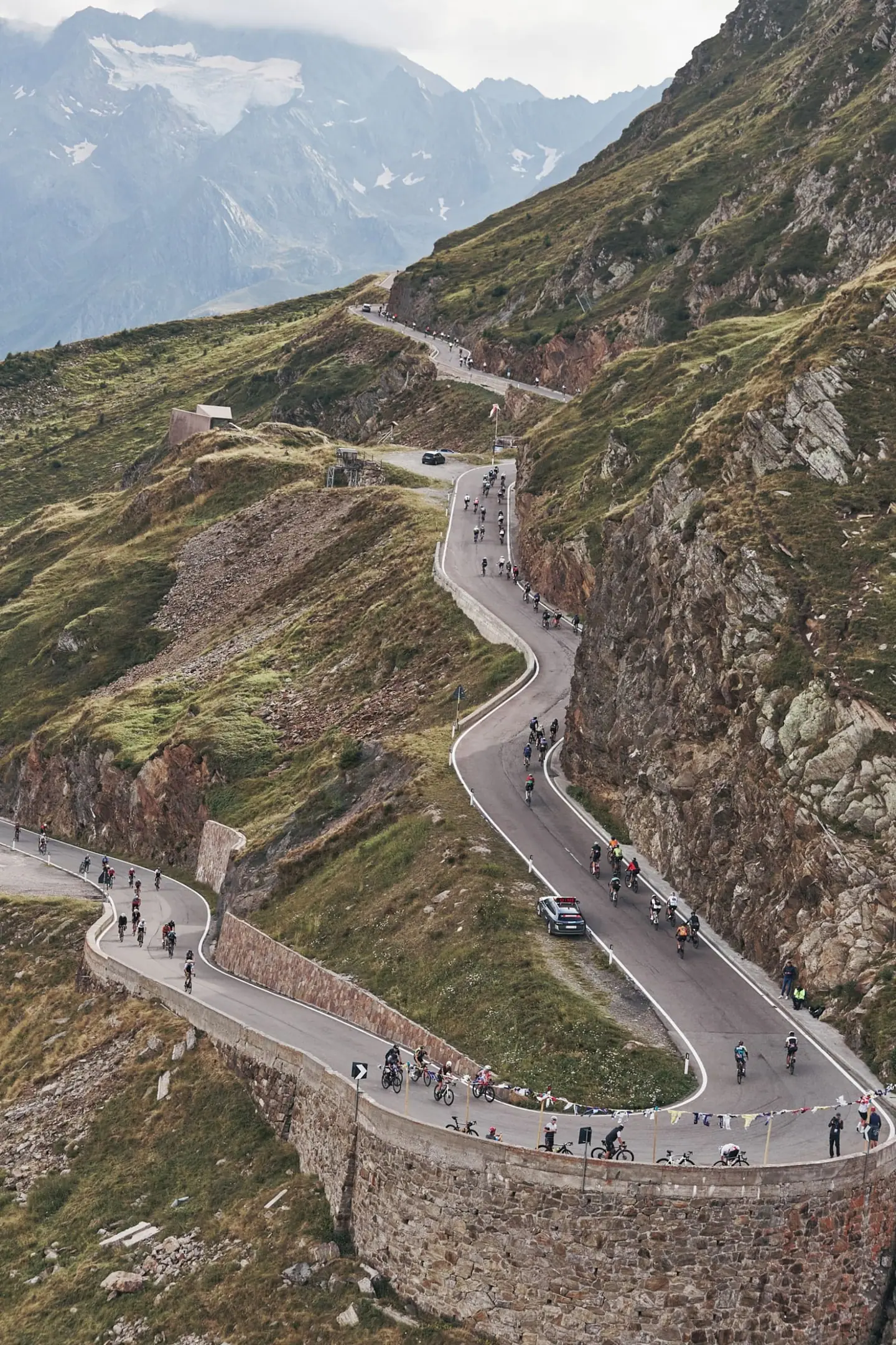
After descending back to Saint-Michel, the Col du Télégraphe starts at km 41: twelve steady forest kilometres at around seven percent. A short drop to Valloire, then the Galibier: 18 kilometres, the last eight above 2,000 m, with long stretches at eight to nine percent. Forest gives way to pasture, then scree and snow, and the top opens onto the Cerces, the Meije, the Dôme des Écrins and Mont Blanc.
The ranking ends at the col, km 76. The remaining 30-odd kilometres are ridden untimed under the highway code: down to Valloire, back up the short, nearly five-kilometre reverse ramp to the Télégraphe, and the long descent to Saint-Michel. Depending on snow conditions the authorities can move the finish to the tunnel about a kilometre below the col.
| Start | Length | Ø | Max. | Gain | Cat. |
|---|---|---|---|---|---|
| km 7.6 | 1.6 km | 10 % | 27.2 % | +155 m | Cat. 4 |
| km 20.9 | 2.3 km | 6.8 % | 20 % | +154 m | Cat. 4 |
| km 23.3 | 6.7 km | 7.2 % | 19.7 % | +479 m | Cat. 2 |
| km 41.4 | 5.5 km | 8 % | 30.6 % | +434 m | Cat. 2 |
| km 47 | 5.6 km | 7.3 % | 27.1 % | +404 m | Cat. 2 |
| km 63.4 | 4.4 km | 7.2 % | 18.6 % | +313 m | Cat. 3 |
| km 68 | 2 km | 8.8 % | 20.9 % | +174 m | Cat. 3 |
| km 70.1 | 6.3 km | 8.5 % | 25.8 % | +531 m | Cat. 2 |
Climb categories follow the road-cycling convention and rate the terrain itself (length and gradient) regardless of sport: Cat. 4 marks the easiest rated climbs, Cat. 1 the hardest, and HC (hors catégorie, “beyond categorization”) is reserved for the most brutal ascents. Short climbs below the Cat. 4 threshold stay unrated.
How to pace Galibier Challenge.
Sit in early
The first half, to Valloire, calls for restraint. Orelle and Beau Plan arrive before your legs are warm and while the bunch is still nervous; climbing above your sustainable output there costs you double on the Galibier. Ride the Télégraphe evenly: its constant gradient suits a fixed power or heart-rate target just below threshold.
Ration your effort
Everything is decided in the final ten kilometres above Plan Lachat. The gradient stiffens, the air thins, and after more than 60 kilometres of up and down little reserve is left. Budget your effort so that you can still lift the pace from Plan Lachat instead of merely surviving it. Keep the time barriers at the Télégraphe and Plan Lachat in mind; an overcautious start can put them at risk.
Race the finale
The trap is altitude. Above 2,000 m the same output feels harder than in the valley, so ride by feel and breathing rather than by the power number from training, and remember that the summit is followed by a long, cold descent and a short climb back up.
Training plan for Galibier Challenge: 12-week build
Build endurance
A committed age-group rider needs roughly four to six hours to the Galibier, and six to eight including the ride back to the valley. The effort is mostly aerobic and steady but long: almost half of the route goes uphill, with hardly any flat road to recover on.
Train the climbs
The decisive section is the Galibier at the end of a day on which you already have three climbs in your legs. Build long rides over several climbs with the longest one last, and do intervals of 20 to 40 minutes just below threshold at low cadence. Sustained climbing at eight to nine percent for an hour or more is the best preparation for the final Galibier kilometres.
Ride race-specific
Conditions are high alpine and early in the season. In early June it can be cold and windy at the top, the road is often still lined with snow, and weather and avalanche risk can move the finish at short notice. Carry a gilet, arm warmers and gloves for the descent, and practise long descents on pass roads, because the return over the Télégraphe to Saint-Michel is steep, twisting and cold.
Arrive fresh
Because the event falls so early in the year, your build has to start in winter and spring. If you can, ride passes above 2,000 m beforehand to get used to the thinner air.

Courses
Download the Galibier Challenge course as a GPX file for your watch or bike computer.
Let YOUB adapt your plan for Galibier Challenge dynamically
Ben connects your goal, the course, current load, recovery, and calendar. Your plan stays pointed at race day even when real life is not perfectly plannable.
Everything about Galibier Challenge.
How long is Galibier Challenge?
Galibier Challenge is 110 km long. That distance shapes how much aerobic endurance, pace durability, and race-specific work belong in the training plan.
How much elevation gain does Galibier Challenge have?
Galibier Challenge has around 3,922 m of elevation gain over 110 km. That affects pacing, muscular load, and preparation for late-race sections.
What is the route profile of Galibier Challenge?
Galibier Challenge is classified as Mountainous, averaging 35.1 vertical metres per kilometre. 9% of the route is flat, 26% climbs moderately (2 to 6%) and 19% is steeper than 6%.
What climbs does Galibier Challenge have?
The hardest climb of Galibier Challenge starts at kilometre 70.1, runs for 6.3 km at an average of 8.5% and gains 531 metres. Cycling-convention rating: Cat. 2. 8 climbs are mapped in total.
Is Galibier Challenge a loop course?
Yes, Galibier Challenge is laid out as a loop: start and finish are in the same place.
Is there a GPX file for the Galibier Challenge course?
Yes. The Galibier Challenge course is on this page as a free GPX download — ready to import into Garmin, Wahoo, Komoot, Strava or any other app that reads GPX.
How should I prepare for Galibier Challenge?
Preparation for Galibier Challenge should account for 110 km, 3,922 m of elevation gain, current training load, and available training time. An adaptive plan helps place key sessions without ignoring recovery and real life.
What pacing strategy works for Galibier Challenge?
The pacing strategy for Galibier Challenge should reflect 110 km, 3,922 m of elevation gain, and your current fitness. Start controlled and keep margin for sections where the profile or fatigue makes target pace harder.
When does Galibier Challenge take place?
Galibier Challenge takes place on June 6, 2027.
Where does Galibier Challenge take place?
Galibier Challenge takes place in Saint-Michel-de-Maurienne, France.
Which distances does Galibier Challenge offer?
Galibier Challenge offers 2 distances — Cyclosportive 110 km: 110 km; Grimpée Chrono du Galibier 35 km: 35 km.
How do I register for Galibier Challenge?
Registration runs through the organiser: galibier-challenge.com. YOUB shows you the course, elevation profile and training plan for your preparation.