Mercan'Tour Bonette DT Swiss.
The Bonette route of the Mercan'Tour Bonette is a high-mountain day in the Mercantour National Park: three big cols, the Cayolle, the Bonette and the Couillole, from Guillaumes up to Valberg. The loop round the Cime de la Bonette at 2,802 metres takes it over what the organiser bills as the highest road of any cyclosportive in Europe.
Mercan'Tour Bonette 2027: Course, Elevation & Route Profile
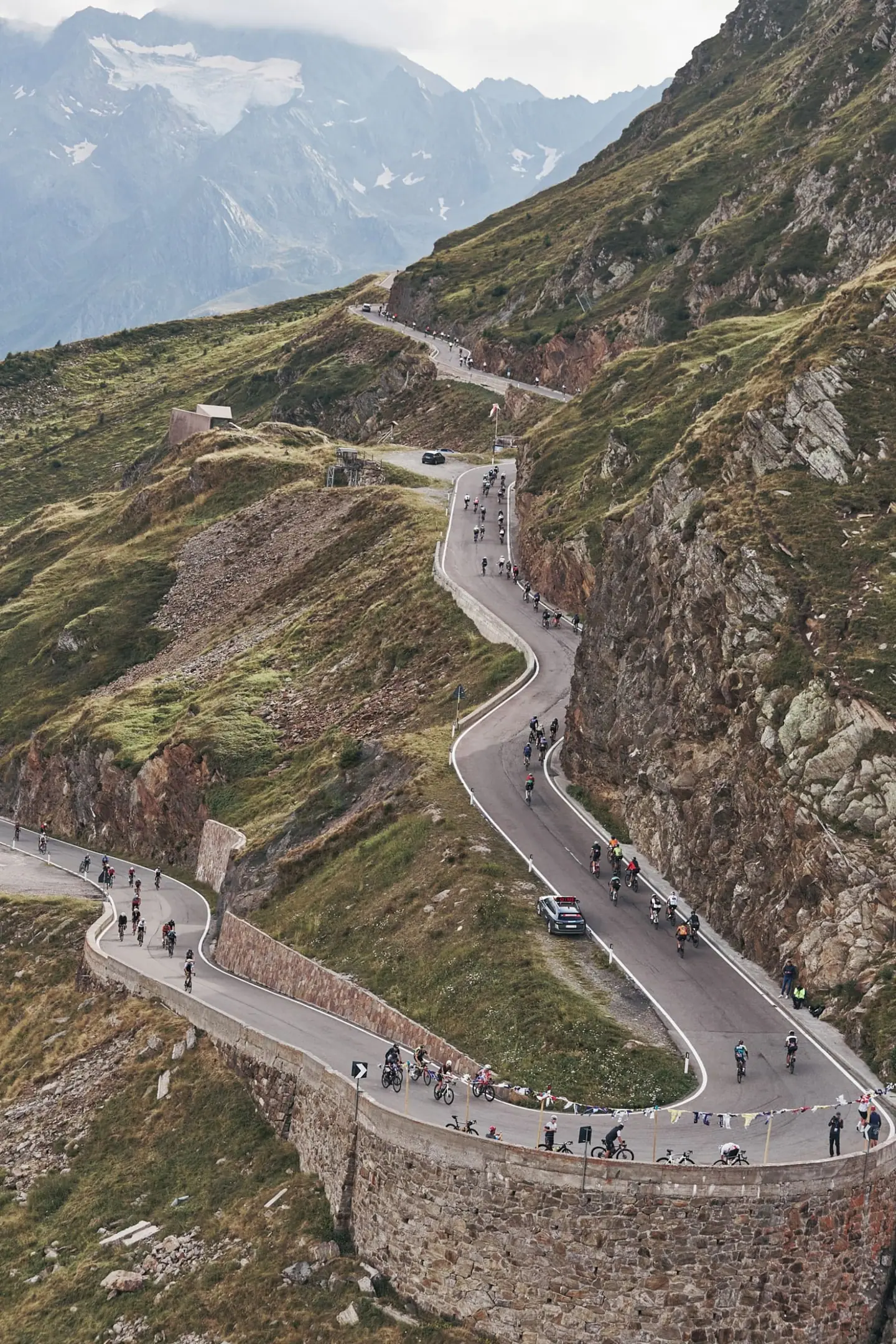
The start is at first light in front of the town hall in Guillaumes, at around 800 metres. After a rolling opening up the upper Var valley, the Col de la Cayolle begins at kilometre 16 via Entraunes: 16 kilometres at close to seven percent to 2,326 metres. Then comes a long descent into the Ubaye valley, where a time barrier at Uvernet-Fours decides who stays on the long route.
From Jausiers, at kilometre 71, the Bonette climbs its northern side: a good 21 kilometres at close to seven percent and nearly 1,500 metres of gain to the col at 2,715 metres, then the short, steeper loop round the Cime. The very long descent runs via Saint-Étienne-de-Tinée to Saint-Sauveur-sur-Tinée, where the Col de la Couillole starts at kilometre 148: more than 15 kilometres at just over seven percent, the steepest long climb of the day. Two short ramps then take you up to the finish in Valberg.
For 2027 the Mercan'Tour returns to the direction of its first editions in 2016 and 2017. The route crosses the core zone of the national park on open roads. In mid-June there can still be snow up high: the Cime loop depends on how much is left, and in bad weather the organiser can change the course.
| Start | Length | Ø | Max. | Gain | Cat. |
|---|---|---|---|---|---|
| km 10.6 | 2.6 km | 5.1 % | 15.7 % | +130 m | Cat. 4 |
| km 13.8 | 1.8 km | 4.1 % | 9.3 % | +75 m | — |
| km 15.8 | 16 km | 6.9 % | 16.6 % | +1,104 m | HC |
| km 70.7 | 21.2 km | 6.9 % | 13.4 % | +1,465 m | HC |
| km 92.4 | 1.1 km | 8.6 % | 23.9 % | +92 m | Cat. 4 |
| km 148 | 15.6 km | 7.4 % | 22.8 % | +1,146 m | HC |
| km 170.6 | 2.1 km | 5.8 % | 11.1 % | +121 m | Cat. 4 |
| km 174.4 | 1.5 km | 5.2 % | 7.8 % | +79 m | — |
Climb categories follow the road-cycling convention and rate the terrain itself (length and gradient) regardless of sport: Cat. 4 marks the easiest rated climbs, Cat. 1 the hardest, and HC (hors catégorie, “beyond categorization”) is reserved for the most brutal ascents. Short climbs below the Cat. 4 threshold stay unrated.
How to pace Mercan'Tour Bonette.
Sit in early
The three cols are similar in length but not in cost. The Cayolle comes early and fresh; the Bonette is the longest climb at over 20 kilometres and goes above 2,700 metres, where thinner air punishes any overreach. Ride the Cayolle well below threshold even with the time barrier in the Ubaye valley in mind; the descent and the valley give you enough time back.
Ration your effort
The day is decided on the Couillole. It starts after about 150 kilometres and more than 3,000 metres of climbing, is steeper on average than either high col, and in the early afternoon often sits in the warmth of the Tinée valley. If you can still hold an even rhythm there, you paced it right.
Race the finale
The trap is the Bonette itself: the altitude and the scenery tempt you to attack the Cime, then to cool down and under-eat on the long descent. Eat and drink on the way down to Saint-Sauveur, not at the foot of the Couillole, and carry a jacket for the descent from 2,800 metres.
Training plan for Mercan'Tour Bonette: 12-week build
Build endurance
For most amateur riders the Bonette route takes eight to eleven hours. The effort is long and steadily aerobic: three climbs of 15 to 21 kilometres, each over an hour long, separated by long descents rather than group riding.
Train the climbs
What counts is being able to climb steadily for another hour after many hours in the saddle. Build long rides of six hours and more with the hardest climb at the end, and ride 30- to 60-minute efforts just below threshold. Gearing that lets you sit and turn seven to nine percent for an hour matters more than peak power.
Ride race-specific
Altitude is the second opponent. Above 2,500 metres power drops noticeably; if you can, ride long passes at height during your build or arrive a few days early. Practise long descents on narrow, hairpinned mountain roads, including in cold air.
Arrive fresh
Mid-June in the Maritime Alps needs kit for a day that runs from a cool morning to snow at the roadside up high and heat in the valleys, plus a fuelling plan for a whole day on the bike.

Courses
Download the Mercan'Tour Bonette course as a GPX file for your watch or bike computer.
Let YOUB adapt your plan for Mercan'Tour Bonette DT Swiss dynamically
Ben connects your goal, the course, current load, recovery, and calendar. Your plan stays pointed at race day even when real life is not perfectly plannable.
Everything about Mercan'Tour Bonette DT Swiss.
How long is Mercan'Tour Bonette?
Mercan'Tour Bonette is 177 km long. That distance shapes how much aerobic endurance, pace durability, and race-specific work belong in the training plan.
How much elevation gain does Mercan'Tour Bonette have?
Mercan'Tour Bonette has around 4,655 m of elevation gain over 177 km. That affects pacing, muscular load, and preparation for late-race sections.
What is the route profile of Mercan'Tour Bonette?
Mercan'Tour Bonette is classified as Mountainous, averaging 26.4 vertical metres per kilometre. 11% of the route is flat, 35% climbs moderately (2 to 6%) and 10% is steeper than 6%.
What climbs does Mercan'Tour Bonette have?
The hardest climb of Mercan'Tour Bonette starts at kilometre 70.7, runs for 21.2 km at an average of 6.9% and gains 1,465 metres. Cycling-convention rating: HC. 8 climbs are mapped in total.
Is Mercan'Tour Bonette a loop course?
Yes, Mercan'Tour Bonette is laid out as a loop: start and finish are in the same place.
Is there a GPX file for the Mercan'Tour Bonette course?
Yes. The Mercan'Tour Bonette course is on this page as a free GPX download — ready to import into Garmin, Wahoo, Komoot, Strava or any other app that reads GPX.
How should I prepare for Mercan'Tour Bonette?
Preparation for Mercan'Tour Bonette should account for 177 km, 4,655 m of elevation gain, current training load, and available training time. An adaptive plan helps place key sessions without ignoring recovery and real life.
What pacing strategy works for Mercan'Tour Bonette?
The pacing strategy for Mercan'Tour Bonette should reflect 177 km, 4,655 m of elevation gain, and your current fitness. Start controlled and keep margin for sections where the profile or fatigue makes target pace harder.
When does Mercan'Tour Bonette DT Swiss take place?
Mercan'Tour Bonette DT Swiss takes place on June 13, 2027.
Where does Mercan'Tour Bonette DT Swiss take place?
Mercan'Tour Bonette DT Swiss takes place in Guillaumes, France.
Which distances does Mercan'Tour Bonette offer?
Mercan'Tour Bonette offers 2 distances — La Bonette 177 km: 177 km; La Cayolle 119 km: 119 km.
How do I register for Mercan'Tour Bonette?
Registration runs through the organiser: granfondomercantour.com. YOUB shows you the course, elevation profile and training plan for your preparation.